| Plan of the turnpike road from Newcastle-under-Lyme to Eccleshall |
Click on image to zoom in.. |
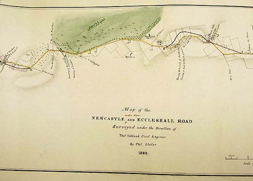
| Plan of the turnpike road from Newcastle-under-Lyme to Eccleshall, surveyed by Thomas Telford, 1822
SRO Q/Rut/5/32
©Staffordshire and Stoke on Trent Archive Service
By the beginning of the 18th century, the condition of many of the county’s roads was extremely poor. The parishes, who were responsible for the upkeep of roads, simply could not keep them in good repair. So the development of turnpiked roads was the solution adopted in the 18th century to improve the state of the county’s highways. The roads improved under the various turnpike trusts set up in 18th century Staffordshire provided the basic infrastructure of today’s road network. A spin off from the development of turnpiked roads was the facilitation of coach travel and the building of large coaching inns, such as The Crown at Stone, The Swan in Stafford and The Four Crosses at Hatherton.
This plan for the turnpike road from Newcastle to Eccleshall, now the A519 was surveyed by Thomas Telford in 1822. |
|