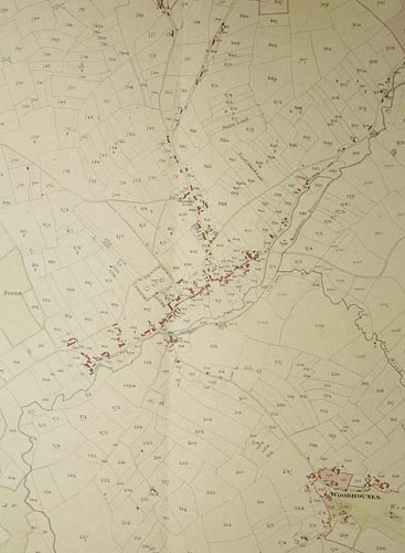
| Enclosure map for the parish of Yoxall |
Click on the image to zoom in..
|
| Enclosure map for the parish of Yoxall, 1815
SRO Q/RDc/58c
©Staffordshire and Stoke on Trent Archive Service
The process of dividing and then fencing, hedging or ditching the former mediaeval open fields into smaller and workable areas of land was called enclosure. In Staffordshire it took place gradually over the centuries, sometimes by private agreement and sometimes by Act of Parliament as in this example for the enclosure of Needwood Forest, which included Yoxall.
Enclosure enabled farming to be carried out independently by extinguishing former common rights held by others over the land being enclosed and by consolidating strips of land in former open fields into workable enclosed fields. It was an agricultural development which was particularly significant as the country tried to meet the demands for food of an increasing population. The process of enclosure also transformed the landscape of the countryside.
This map clearly shows what are distinguishable from their shape as strips in former open fields, now brought consolidated by the enclosure process. |
|